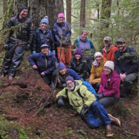
Discovery staff ‘out-the-road’
Exploring Eeyák’w, small rapid (Amalga Salt Chuck) On December 2nd & 3rd, a dozen naturalists gathered for review and planning.…
DiscoverySoutheast.org

If you clicked-open this category, you obviously have no fear of acronyms. In fact you might be more tech-savvy than me. My goal here is not to explain what LiDAR is, so much as what it can do for those of us in Áak’w & T’aakú Aaní, land of Auk and Taku people (CBJ), who—thanks to the foresight of land managers at the City & Borough—were suddenly gifted with this extraordinary technology in 2014. With Koren Bosworth, Cathy Pohl and Andrew Allison, I used LiDAR every day in the most intensive ground-truthing project of my career. It lifted our work to a new level of accuracy, efficiency, and interpretive sophistication.

Landforms from RD Miller’s 1972 surficial geology map, overlaid on LiDAR-generated ‘bare-earth.’ Streams are also predicted from the LiDAR digital elevation model (DEM). Our ground-truthing in 2014 found these to be quite accurate.
LiDAR is so arcane and geeky that people actually argue about what the acronym stands for. (“Although thought by some to be an acronym of Light Detection And Ranging, the term lidar was actually created as a portmanteau of ‘light’ and ‘radar”‘) For our purposes, think of a small plane at about 3000 feet, shooting down millions of light pulses, reflected back, carrying information about topography. For what’s called the bare-earth model, all the LiDAR returns from vegetation are filtered out.
But what’s just ‘noise’ to geologists is a goldmine to forest ecologists. The
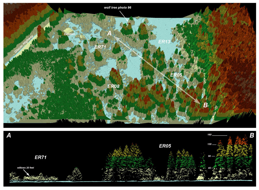
Oblique view and belt profile through the LiDAR ‘point cloud.’ From our desks we can now measure the height of any tree in Juneau to the nearest foot.
LiDAR point cloud can be reassembled, for viewing either in a rotatable 3D model (upper example), or side-view profile (belt A-B, below). This example is from the formerly tidal uplift meadows near Eeyák’w, small rapid (Amalga Salt Chuck).
Since the CBJ LiDAR commission in 2013, other communities have jumped aboard. As of 2018, it’s available for the road systems of Ketchikan and Sitka. Hoonah has LiDAR for a much larger area—what they define as the Hoonah Community Forest. And even larger is the recent LiDAR project for the northern two thirds of Tàan, sea lion (Prince of Wales Island).
In the links below I’ve listed several slide shows that detail the use of LiDAR for different mapping and interpretive projects. New tools for old naturalists was a talk for the USFS Fireside series, with many examples of the use of LiDAR in wetland mapping, landform interpretation, and big-tree hunting. Supplement to the CBJ wetlands surveys gives more technical background.
Exploring Eeyák’w, small rapid (Amalga Salt Chuck) On December 2nd & 3rd, a dozen naturalists gathered for review and planning.…
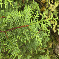
A mysteriously rare and declining species X̱áay (yellow-cedar) is dying in much of its maritime, more southerly range, such as…
2025 | Richard Carstensen | 1 minute slideshow & 10 page journal
Glacial topography on 2023 LiDAR terrain model We recently received a new LiDAR dataset commissioned by USGS, that just barely…
2025 | Richard Carstensen | 1 minute slideshow
Tracking & navigation workshop, upper Áak’w Táak (M-word Valley) Discovery Southeast has a strong relationship with the Forest Service’s Glacier…
2024 (& 2017) | Richard Carstensen | 4- & 2-minute slideshows, 17MB journal
We live in kind-of a bowling alley . . . . . . so one might hope we’ve become more…
2023 | Richard Carstensen | 50-second video; pdf downloads
Goats, geology & zonation on Shaa Tlaax, moldy top (Mt Juneau) Video-journal of the flora, fauna, and geomorphology that hikers…
2019 | Richard Carstensen | 4 minutes
Better basin boundaries During the Juneau wetland surveys in 2014, the Bosworth Botanical team (Koren Bosworth, Catherine Pohl, Andrew Allison…
2014 | Richard Carstensen | 4 pages
On a sleety December 11th, 2018, Discovery Southeast staff (and Clay Good, board) hiked together in the lower valley of…
2018 | Richard Carstensen | 7 minutes
The Tongass needs 50 athletes with ground-truthing skills, to range the timberlands each summer by bike, skiff, 4-wheeler and kayak,…
2018 | Richard Carstensen | 14 pages
There are several online sources for LiDAR products originally commissioned by the CBJ for our wetland surveys. Both the bare…
2021 | Richard Carstensen | 3 pages
In summer 2014, Koren Bosworth, Cathy Pohl, Andrew Allison and I surveyed wetlands throughout the CBJ. Although we were not…
2016 | Richard Carstensen | 31 page excerpt (of 512p)
Aerial views of post-glacial succession. Combines UAV perspectives with high-res orthophotography plus forest profile views in the LiDAR point cloud.…
2017 | Richard Carstensen | 20 minutes
Remapping with Montessori For a teacher at any of the downtown schools (Harborview, Montessori, JD High) with only an hour’s…
2017 | Richard Carstensen | 13 minute slideshow
The 21st-century cartographer New tools for old naturalists In March, 2015, I gave a fireside presentation at the Mendenhall Visitor…
2015 | Richard Carstensen | 31 minutes
In March, 2015, I gave a banquet presentation to the Alaska Chapter of the Wildlife Society. Afterwards, I archived it…
2015 | Richard Carstensen | 31 minutes
For the sesquicentennial year of the 1867 Alaska Purchase, Juneau-Douglas City Museum asked me to create 3 banners showing 150…
2017 | Richard Carstensen | 28 minutes
Background paper for 3 banners commissioned by the Juneau Douglas City Museum, showing changes to iconic landscapes of Áak’w Aaní…
2017 | Richard Carstensen | 41 Pages