
Teachers at Fish Creek, 2022
Four days at the delta and Eaglecrest From June 9 to 12, 2022, Discovery gave the 4th in our series…
2022 | Richard Carstensen | 46 page journalDiscoverySoutheast.org


Geopdfs from LiDAR for lower and upper Aangooxa Yé watershed.
According to different sources, Aangooxa Yé translates beside the slaves of the town, or where slaves go to put up food (Olson & Kunz, 1992). It was apparently an important summer camp, but—perhaps due to dark, north-facing aspect—probably never served as year-round village.
Discovery Southeast naturalists have used Fish Creek estuary for teaching animal tracking and sign interpretation to thousands of elementary school students since 1989. The diverse habitat mosaic and good connectivity concentrates wildlife.
In 2020, Discovery is collaborating with the Southeast Alaska Watershed Coalition to document habitats at Fish Creek Delta.

Dredge Pond breached in the Thanksgiving Day storm of 1984—now a major king salmon fishery.

Deer cabbage turning along Heavenly Overlook Trail, Eaglecrest.

Bedrock and surficial geology of Aangooxa Yé (Fish) watershed. Fish Creek fault runs through Áakw (Auke Lake) on the mainland, and continues SE through Kanak‘aa (Seymour Canal) on Xutsnoowú (Admiralty).
Four days at the delta and Eaglecrest From June 9 to 12, 2022, Discovery gave the 4th in our series…
2022 | Richard Carstensen | 46 page journal
Focus group tour On Thursday, August 26th, about 30 masked aficionados of dynamic Fish Creek delta assembled on invitation from…
2021 | Richard Carstensen, Bob Armstrong | RC-59 pages: BA vid-links
Hydrology in the point cloud. Maybe it’s all those years stippling scenes and species portraits, point by point with double-ought…
2020 | Richard Carstensen | 2-minute slideshow
Discovery-SAWC collaboration Beginning in early 2020, Discovery Southeast is assisting the Southeast Alaska Watershed Coalition with investigations at Fish Creek…
2020 | Richard Carstensen |
High-resolution GeoPDF pair for field navigation at Eaglecrest, central Sayéik, spirit helper (Douglas Island), in the headwaters of Aangooxa Yé,…
2018 | Richard Carstensen | 2 geoPDFs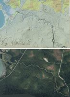
High-resolution GeoPDF pair for field navigation at Angooxa Yé, where slaves put up food (Fish Creek) on northern Sayéik, spirit…
2018 | Richard Carstensen | 2 geoPDFs
In summer 2014, Koren Bosworth, Cathy Pohl, Andrew Allison and I surveyed wetlands throughout the CBJ. Although we were not…
2016 | Richard Carstensen | 31 page excerpt (of 512p)
Supplement to the 2016 Juneau Wetlands Management Plan In summer 2014, Koren Bosworth, Cathy Pohl, Andrew Allison and I surveyed…
2018 | Richard Carstensen | 8 separate pdfs, 2 to 5 MB
In 2010, on contract with CBJ Parks and Recreation, Discovery designed 3-panel sign arrays for 10 trailheads on (or leading…
Richard Carstensen | 1 page
In 2010, on contract with CBJ Parks and Recreation, Discovery designed 3-panel sign arrays for 10 trailheads on (or leading…

In September, as deer cabbage turned gold, I flew some of the new trails on ridges above the lifts. eaglecrestaerials…
2017 | Richard Carstensen | 2 minutes
Four-fold brochure created for the CBJ Natural History Project describes 12 interpretive stations at Fish Creek estuary. On your phone,…
2013 | Richard Carstensen | 2 pages