Seaforms & the Great Wave of 2025
Mountainside detachment in North S’awdáan Fiord (Tracy Arm) On August 10th, 2025, an enormous section of mountain fell into the…
2026 | Richard Carstensen | 46 page pdf 24mbDiscoverySoutheast.org
What do snow avalanches, mudslides, mountainside bedrock detachments and glacial outburst floods have in common? I guess they’re all “gravity events“. In all cases, serious stuff perched above vulnerable lowlands somehow becomes mobilized. I used to say “bad stuff,” but that’s judgemental. Gravity, like wolves and wildfire, is both destroyer and creator.
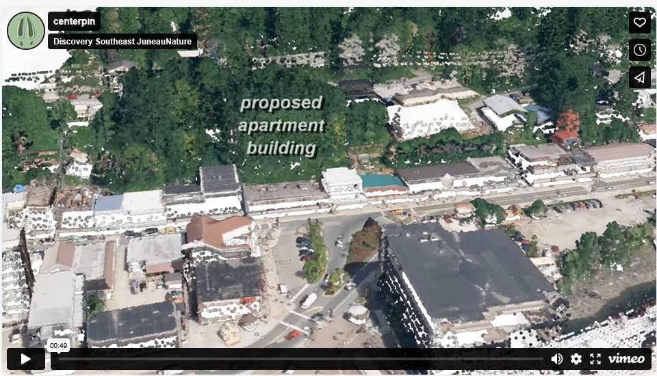
My page on mudslide path-7, near downtown parking garage, shows context for proposed new apartment complex
In Lingít Aani, the trigger for these tantrums is usually hard rain or alpine blizzard, sustained over several days. Jökulhlaups, too, are like slo-mo avalanches, but their trigger is a back-watered lake who suddenly discovers subglacial plumbing. Since each of our gravity events has made national news over the past several years, one might hope we’re more attentive to and foresightful of such hazards. Obviously, during storms, but also, more proactively, in choice of homesites, roads, and even boating destinations. Fortunately, we have great new tools for measurement and visualization.
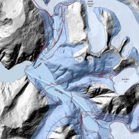
After catastrophic discharges, accelerating throughout Lingít Aaní and the world, LiDAR allows us—especially when ‘before-&-after’ missions are fortuitously paired—to quickly investigate both biotic (point cloud) & abiotic (bare earth) contexts. Since 2020, I’ve applied LiDAR and historical photography in review of a series of gravity tantrums. Some were tragic and some were ‘near-misses’ in terms of human life. Almost all had expensive and traumatic consequences, except the biggest one, BY FAR, which miraculously killed nothing but trees and fish and, as of August 2025, seems out-of-sight-out-of-mind, at least in my HESCO-distracted hometown. I’m referirng to the mountainside detachment in North S’awdáan Fiord (Tracy Arm)
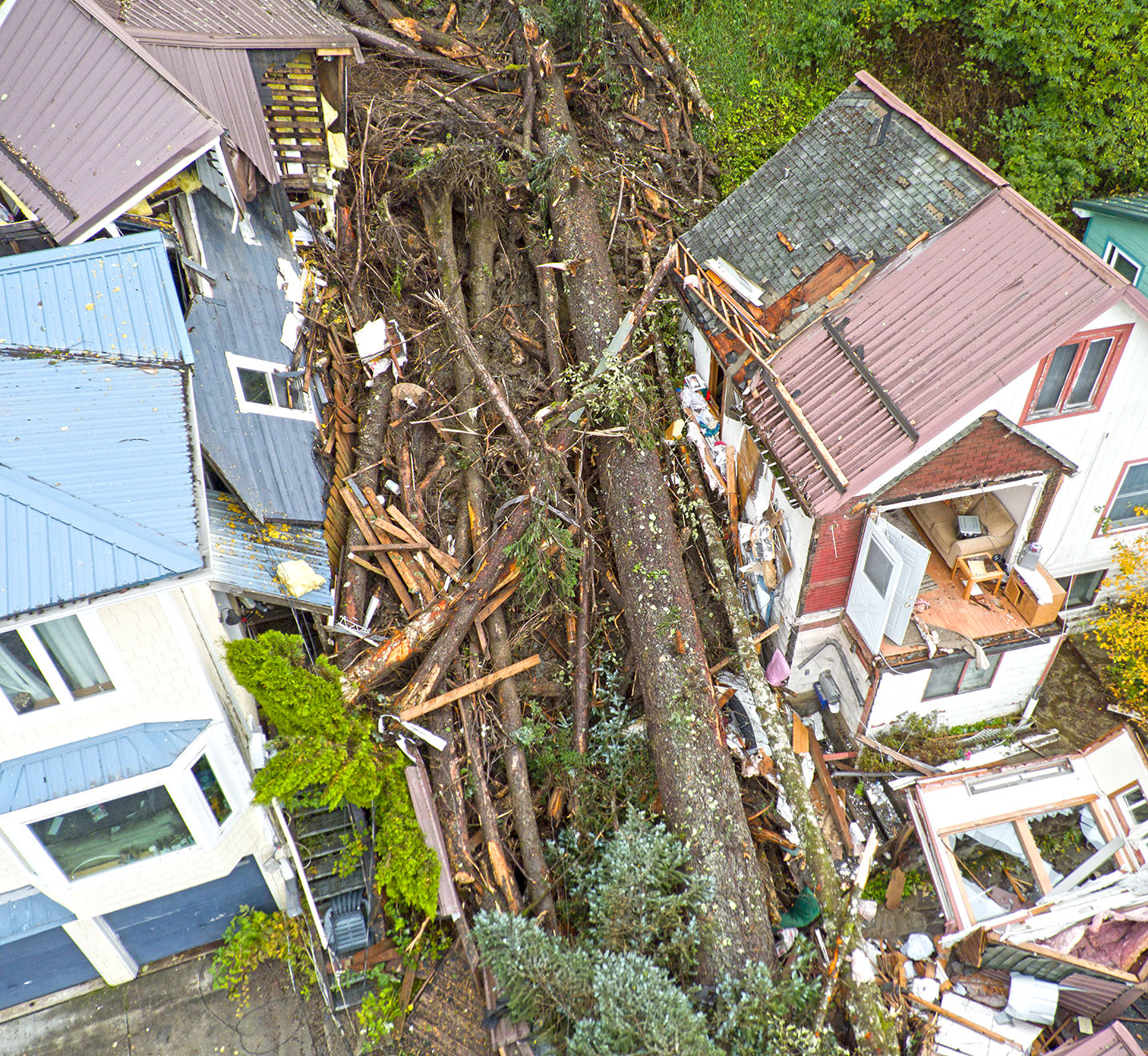
On the most recent of my Blackwell walks with geologist Cathy Connor, last of the summer-25 series for JD City Museum, our dozen explorers scrutinized RD Miller’s masterful map of downtown landforms. Attendees typically include longtime residents, many of whom grew up or migrated here even before Cathy and I arrived. That’s a lot of pooled memory and wisdom. Where, we wondered, would be the best place to live, or run to, in the event of an avalanche? Tsunami? Mudslide? Soil-liquifying earthquake? Each disturbance, we concluded, had a different ‘best-place’ and ‘worst-place.’
It almost makes you wonder if putting down roots is a good idea at all in tantrum-teased topography. Trees can’t dodge. I say this of course, a little tongue-in-cheek—but not entirely. To take the most recent example, should we armor View Drive (dig in?) Or buy it out and make that 1885 moraine a natural-area park that we close down every August (ie, dodge)?
Mountainside detachment in North S’awdáan Fiord (Tracy Arm) On August 10th, 2025, an enormous section of mountain fell into the…
2026 | Richard Carstensen | 46 page pdf 24mb