Seaforms & the Great Wave of 2025
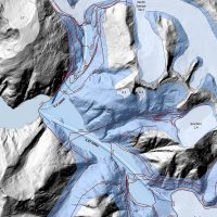
Mountainside detachment in North S’awdáan Fiord (Tracy Arm) On August 10th, 2025, an enormous section of mountain fell into the…
2026 | Richard Carstensen | 46 page pdf 24mbDiscoverySoutheast.org

In winter 2020-21, I became interested in the geology and ecology of steep slopes—neither lowland nor highcountry—that dominate viewsheds of most Southeast Alaskan residents. Oddly, I hadn’t much focused on these precipitous habitats—and I’m not sure anyone else has either, except for a few grouse hunters and avalanche researchers. Partly, it’s rational avoidance. Here’s how Doug Chadwick describes the habitat in Beast the color of winter, 1983:
“Take a staircase in your home (30 to 35 degrees), tilt it to match Egypt’s Great Pyramids (52 degrees), remove some of the steps, and shovel ice and snow over the whole affair. . . Then move the whole concocted cliff atop an apartment building so the next step below bottom is at least a couple stories down.”

My definition of Goatlandia has expanded a bit since beginning Jánwu studies in October, 2020. Safe to say, though, that not much of it is flat!
As for my annoying subtitle, the ‘unviewed viewshed, ‘ sorry, :) That’s a rebuke not to you but to me. As a wannabe natural history jack-of-all-trades—what Matt Goff humbly calls “aspiring,”—I’d like to think I notice stuff that drops through cracks in scientific specialties. With steep places though? . . . Not so much.
One of the blades in ArcMap’s swiss-army-knife for analyzing/visualizing terrain is called the viewshed tool. Clicking your observation point on a DEM (digital elevation model), the tool creates a polygon highlighting everything a viewer there can see. It’s used primarily in landscape architecture, the discipline of (cynically speaking) making our residential-and-recreational world seem less damaged than it really is. Until stumbling into goatography, I hadn’t used it much.

Pink tints are nearby conifer-tops and distant cliffs-&-alderjungles viewable from my observer point on Behrends Avenue.
Until recently, viewsheds have built upon relatively crude ~30-meter terrain models. But it occurred to me that thanks to LiDAR, by clicking on Δobserverpoint—my standard tripod station at Behrends Avenue—I could generate a more detailed viewshed, showing literally every goatcliff, and even the sprucetops blocking them in our Highlands neighborhood foreground.
Picture yourself in lowlands, but close to that ’tilted staircase’ in Doug Chadwick’s quote above. The viewshed tool will illuminate its ‘risers’, but the ‘treads’ are mostly hidden. In mostly mountainous Lingít Aaní, 99% of human activity transpires in this bowlbottom. But who among us really sees its walls? Yeah, if transported to Kansas, we’d miss it. Yet I can’t think of a single scientific study addressing the ecology of Goatlandia, or even defining it as a legitimate habitat. We’re pretty good on flat-&-gentle places, and passable on the alpine-subalpine convexities (well, maybe mostly flunking . . . ) But in between. . . that’s the unviewed viewshed. Maybe it takes a neighborhood evacuation to get us measuring things?
When we’re not there To learn what wintering mountain goats are up to in places we can’t scan with spotscopes, Discovery naturalist Steve Merli and I have deployed motion cams in steep forested habitats. Climbing to and from these cameras we’re almost constantly in sight of super-tall Sitka spruce. This was first of many unexpected discoveries about steep places. During the Landmark Trees project, 1996 to 2005, I’d never have suspected that colluvial (gravity-deposited) landforms might support higher-scoring mega-stands than our finest forests on alluvial (water-deposited) fans and floodplains. Not until receipt of LiDAR in 2014 have we been able to easily identify tallest trees in local watersheds.

Danny Stahle, Erich Pietzch (USGS, Montana) and Eran Hood (UAS) coring on margins of Nettleslide. Impact scars in the tree-ring sequence give dates of past avalanches.
In early June, 2021, I joined UAS researcher Eran Hood, and tree-ring dating experts from Montana on slopes above our Highlands neighborhood. Snow avalanches and rockfall bombard Goatlandia conifers and alders, leaving evidence in tree rings. These clues are assembled into a story of disturbances from minor and localized to catastrophic, of interest to skiers, avalanche forecasters and especially residents downslope. Studies will fine-tune maps of recurrence intervals. Eran and Erich’s Fireside in Feb 2021 summarized year-one of their project.

Nettleslide (Behrends Avenue chute) is one of the most dangerous urban avalanche paths in North America. Disturbance regime also creates some of the finest winter goat range in Lingít Aaní.
Ribs and gullies On mainland cliffs facing Séet ka (Gastineau Channel), giant-tree forest closely alternates with tangled slide alder. This combination gives Jánwu, mountain goat, the ideal combination of deep-snow refugia and ultra-rich foraging terrain. Intermediate between these extremes is tall-spruce-red-alder woodland. Because this habitat has only just come to my attention, I can’t say how widespread it is. On very steep slopes above J-town—around the orange eye for example—this open woodland offers better forage than closed conifer forest, along with snow interception giving access to grazer-browsers when slide paths are deeply buried. I suspect some of the majestic red alders could reach 200 years, unheard of in rainforests to the south.
Mountainside detachment in North S’awdáan Fiord (Tracy Arm) On August 10th, 2025, an enormous section of mountain fell into the…
2026 | Richard Carstensen | 46 page pdf 24mb
Jánwu of Áak’w Aaní On Feb 6, 2026, I gave a talk in the Fireside series at Glacier Visitor Center.…
2026 | Richard Carstensen | 30 minute slideshow
T’aawáḵ dísi ● when geese fly & call (January) Best wishes for 2024! I noticed on the trail, this January…

Where do mature males go when rut has ended? Soon after we began near-daily observations of mountain goats in autumn,…
2024 | Richard Carstensen | 12 minute slideshow
We live in kind-of a bowling alley . . . . . . so one might hope we’ve become more…
2023 | Richard Carstensen | 50-second video; pdf downloads
Oblique aerials after the last big one In a binder of slides and negatives that Brita Bishop lent me, I…
1985 | Dan Bishop | 7 pages
Motioncam at 600 feet In mid-December, 2022, 9 of us Discovery naturalists bushwhacked up into mountain goat winter range to…
2023 | Richard Carstensen | 3 minute slideshow
Snowslides and critters Last year around this time I posted video and thoughts about the relationship of critters to avalanches—both…

Avalanche and wildlife It’s hard to think long about mountain goats—especially here on the precipitous coast—without wondering how they deal…
2022 | Richard Carstensen | 3 minute slideshow
Releases in Nettleslide (Behrends path) & Last Chance Goatwatching in winter leads inevitably to fascination with avalanches. Yesterday, Feb 12,…
2022 | Richard Carstensen |
Wrapping up the 2021 Jánwu journal January 1st, 2022: Most radio commentators appear quite ready to bid good riddance to…

Rainforest rut Last fall I described elements of rutting season in mountain goats, but did not attempt a comprehensive review.…
2021 | Richard Carstensen | 9 minute slideshow
3D perspectives on Janwú’s home My mountain goat observations dating back to 2015 fill 3 enormous journals. During that time…
2021 | Richard Carstensen | 15 pages of excerpts
Year-3: Estuaries & steep places Two kinds of landforms & habitats have consumed my attention this winter and spring—estuaries and…
2021 | Richard Carstensen | 60 page journal & course manual
Follow-up to the 108-days show Back in April, 2021, Steve Merli and I posted a 12-minute slideshow called 108 days…
2021 | Richard Carstensen & Steve Merli | 9-minute slideshow
Motion-detector camera at 1,200 feet On December 12th, 2020, Steve Merli and I placed a game-cam in mountain goat winter…
2021 | Richard Carstensen | 12-minute slideshow
Avalanches in Goatlandia Yesterday (20210304), avalanches were triggered above the Thane Road runout on Snowslide Creek. Several folks posted impressive…
2021 | Richard Carstensen | 80-second slideshow