
GeoPDFs Ch’eet’ Taayí (Cowee-Davies)
Medium-resolution GeoPDF pair for field navigation in Ch’eet’ Taayí, murrelet fat (Cowee) watershed. For coastal regions, download the higher-res LiDAR-based…
2018 | Richard Carstensen | 2 geoPDFsDiscoverySoutheast.org


Avenza on iPhone. Also works on Android. Custom geopdf generated from CBJ LiDAR, with 2-foot contours. On launching, remember to Record GPS Tracks. In Plot Photos you can name pics and create photopoints. On completion, email yourself or friends a zipped kmz with the track and points.
Many of the maps viewable and downloadable from JuneauNature are centered on popular trails. Trails are cool. I’ve written a 72-page guidebook about them. But on page 65, I admitted:
‘Juneau’s trails are wilderness training wheels. Ultimately, good hunters, gatherers, naturalists and visionaries step off the trail.’
Should you try that, one option is a geoPDF.
Note, 2026: If you have visited this page before, you’ll remember that i’m a big fan of the app Avenza. Over the past decade I’ve created hundreds of custom geopdfs, and dozens of them can be downloaded here at JuneauNature. The entry-level app was free, and worked on both iphone and android.
Unfortunately, as of summer 2026, Avenza has gone to subscription-only. Not a problem for me personally, or my friends who are hard-core bushwackers, because constant users can justify it. But for casual off-trail explorers who might use a geopdf, say, just a couple times per year, I can’t recommend a subscription fee. And I won’t serve as sales-promoter for commercial apps or devices, however useful they are.
Local geopdfs will remain archived on JuneauNature. But running them in Avenza may not be the best choice for you. Most folks I know who go offtrail use the app Gaia. Premium users can apparently load custom geotifs, so if you do GIS that may be a $60/yr option for creating high-res, custom-layered rasters. For those who bite the $35/yr bullet and stick with Avenza, Here’s some tips on workflow
Subscription Avenza: A geopdf is a ‘smart-pdf’ containing spatial coordinates. Using the GPS on your phone or tablet, (works offline) you display your position on these custom maps, lay down a track, or take waypoints. Pictures taken from your device display on Avenza maps as thumbtack photopoint icons. These are later exported along with the track to kmz for display on Google Earth, or converted to shapefile for use in ArcMap.
Once Avenza is installed to your phone, download one of my dozens of custom geopdfs, or, say, a free USGS topographic map in geopdf format. Once it’s loaded, tapping that upward arrow on the footer, you’ll be asked which of a number of apps to open it in. Scroll to the Avenza icon. It’ll take awhile to format but when finished, you can open that mapview and begin to explore the simple Avenza menus. (Normal pdfs are usually opened in apps like Acrobat. If you get choice of opener, tap ‘this time only‘ rather than making avenza your default pdf-opener)

Recipients of your google earth kmz can scale in and out, and open each photo by clicking the named thumbtack icons
In my Media types > Maps section, most of the linked maps are geoPDFs. I’ve exported them from ArcMap for popular hiking destinations throughout Áak’w Aaní—and a bit of Chilkat country as well. Some are based on high-res orthophotos; others are on LiDAR- or IfSAR based hillshade, overlain with layers such as streams, fine contours, geology, trails, etc. I like to load one of each to my phone or tablet for hikes, and often alternate between them depending on whether I’m considering landforms or vegetation cover. Base-level Avenza subscription now (2026) holds 20 geoPDFs at a time. As that library gets full, clean off pdfs you don’t use often. Remember, you can reload them at need.
Stay tuned to this page as I build out the geoPDF collection. They cover many local trails and all of the surroundings of public schools—places where Discovery Southeast naturalists bring students on field trips. And I love creating more for friends, Let me know what you need.
Early GPS was pretty sketchy in the dense Southeast rainforest, sometimes losing reception altogether under particularly tall trees, near steep hillsides, and at certain ‘weak’ times of day.Today, most devices include GLONASS, Russia’s version of America’s GPS. This has improved reception at high latitudes, and in dense forest.
My android phone has a pretty good GPS, suitable for navigation. But at the end of a survey, or simple recreational hike, I sometimes need a more accurate track, which is then used to generate better photopoints (by linking timestamps) than I can get from phone or camera. Since 2016 my solution has been the tiny bluetooth Bad Elf GPS Pro+. More on GPS and navigation in general is in Ground truthing methods.
The trails layer in my CBJ ArcMap project is a work in progress. Building off the USFS layer, I’ve been slowly fine-tuning it with Bad Elf tracks, and—where trails show on aerials and LiDAR hillshade—by tracing from high-res 2023 orthoimagery & bare-earth. If you have more accurate tracks for any trail on my GeoPDFs, email em to me, as .gpx, .kmz, or .shp.
I love my navigation toys. But let’s close with a caveat about technology, adapted from a sidebar in our course manual What would Raven see:
Sitka anthropologist Richard Nelson remembers that when younger Inuit first began to use compasses, the elders worried. The compass, they claimed, was weakening peoples’ intimacy with their treeless northern landscape. No longer could hunters orient themselves by the concordance of subtle natural signs, such as the way snow deposits in prevailing winds. The compass was in some ways weakening peoples’ relationship with their environment.
Today the compass—once ‘cutting edge’—is now increasingly left behind by outdoorspeople armed with more advanced navigational tools. As of 2015, even dedicated GPS units are being displaced, because our phones and watches ‘can do all that.’ But does ever-advancing technology place even more buffers between the navigator and the terrain? Few would suggest we abandon useful tools such as compasses or GPS units. But we should remember Adaa analgéin—Raven’s way of studying the world. Do our tools sharpen or dull our perceptions?
Medium-resolution GeoPDF pair for field navigation in Ch’eet’ Taayí, murrelet fat (Cowee) watershed. For coastal regions, download the higher-res LiDAR-based…
2018 | Richard Carstensen | 2 geoPDFs
Medium-resolution GeoPDF pair for field navigation in the glacial watersheds of Asx’ée/L’ux, twisted tree/milky water (Eagle/Herbert). For the delta-confluence region,…
2018 | Richard Carstensen | 2 geoPDFs
Medium-resolution GeoPDF pair for field navigation in Shaanáx Tlein, big valley (Lemon) and Til’héeni, dog salmon creek (Salmon) valleys. In…
2018 | Richard Carstensen | 2 GeoPDFs
Medium-resolution GeoPDF pair for field navigation in Aak’w Táak, inland from little lake (Mendenhall Valley) and contributing valleys or ‘tribsheds’.…
2018 | Richard Carstensen | 2 geoPDFs
Medium-resolution GeoPDF pair for field navigation in Kaawa.ée Héenak’u, Kaawa.ée’s little creek (Kowee) and Shgóonaa Héenak’u, schooner’s little creek (Lawson)…
2018 | Richard Carstensen | 2 geoPDFs
Medium-resolution GeoPDF pair for field navigation in Dzantik’i Héeni (Gold) and Chaas’héeni (Sheep) watersheds. In apps such as Avenza, on…
2018 | Richard Carstensen | 2 geoPDFs
High-resolution GeoPDF pair for field navigation at Chaas’héeni, humpy stream (Sheep Creek), and Koosh, oozing sore (Thane area) The Olson/Kunz…
2018 | Richard Carstensen | 2 geoPDFs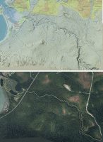
High-resolution GeoPDF pair for field navigation at Angooxa Yé, where slaves put up food (Fish Creek) on northern Sayéik, spirit…
2018 | Richard Carstensen | 2 geoPDFs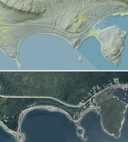
High-resolution GeoPDF pair for field navigation at Aanchgaltsóow, nexus town (Auke Rec) and X’unáxi, camping place (Auke Cape). In apps such…
2018 | Richard Carstensen | 2 geoPDFs
High-resolution GeoPDF pair for field navigation around inner Áak’w Tá, little lake bay (Auke Bay). Includes Áak’w, little lake, and…
2018 | Richard Carstensen | 2 geoPDFs
High-resolution GeoPDF pair for field navigation in upper Áak’w Táak, inland from little lake (Mendenhall Valley). Includes on-foot destinations from…
2018 | Richard Carstensen | 2 geoPDFs
geopdf_valleyloweraerial2019 High-resolution GeoPDF pair for field navigation in lower Áak’w Táak, inland from little lake (Mendenhall Valley). Includes on-foot destinations…
2018 | Richard Carstensen | 2 geoPDFs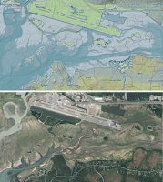
High-resolution GeoPDF pair for field navigation on the Airport Dike Trail and adjacent tidal wetlands. Also shows coastline on the…
2018 | Richard Carstensen | 2 geoPDFs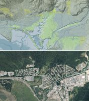
High-resolution GeoPDF pair for field navigation on trails in lower Shaanáx Tlein, big valley (lower Lemon Creek watershed). All of…
2018 | Richard Carstensen | 2 geoPDFs
High-resolution GeoPDF pair for field navigation on trails behind Sayéik, spirit helper (Gastineau Elementary). In apps such as Avenza, on…
2018 | Richard Carstensen | 2 geoPDFs
High-resolution GeoPDF pair for field navigation on roads and trails of downtown Juneau. In apps such as Avenza, on your…
2018 | Richard Carstensen | 2 geoPDFs
Place-based technologies Update, 2023: Every 5 years or so I create an updated description of my methods and workflow: prefield…
2023 | Richard Carstensen | 4 pages
High-resolution GeoPDF pair for field navigation around Chookan Aaní, grassy land (Mendenhall Peninsula) and the western Refuge, where Pederson Creek…
2018 | Richard Carstensen | 2 geoPDFs
Field journaling as Raven goes global Journaling is my work and play. It’s how I taught myself to be a…
2011 | Richard Carstensen, Kathy Hocker, Kevin O'Malley | 16 pages