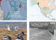
Medium-resolution GeoPDF pair for field navigation in Ch’eet’ Taayí, murrelet fat (Cowee) watershed. For coastal regions, download the higher-res LiDAR-based map pair. In apps such as Avenza, on your phone or tablet, you can see your GPS/cell-triangulation position on this image, and lay a track. First choice is an IfSAR-derived bare-earth hillshade with streams from USFS and 50-foot contours. Other layers, exported from ArcMap, are named roads and hiking trails. Thick blue lines are “subsheds,” mapped during the CBJ Wetlands project.
The second choice is an orthophoto with overlain streams and trails. More information on geoPDFs and use of Avenza is at Media types>Maps&geoPDFs., and at Tools>Field navigation.
Download hillshade geoPDF here (5MB)![]()

Download airphoto geoPDF here (8.5MB)![]()