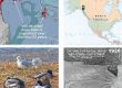
Medium-resolution GeoPDF pair for field navigation in the glacial watersheds of Asx’ée/L’ux, twisted tree/milky water (Eagle/Herbert). For the delta-confluence region, download the higher-res LiDAR-based map pair. In apps such as Avenza, on your phone or tablet, you can see your GPS/cell-triangulation position on this image, and lay a track. First choice is an IfSAR-derived bare-earth hillshade with streams from USFS and 50-foot contours. Other layers, exported from ArcMap, are named roads and hiking trails. Thick blue lines are “subsheds,” mapped during the CBJ Wetlands project.
The second choice is a 2009 orthophoto with overlain streams and trails. More information on geoPDFs and use of Avenza is at Media types>Maps&geoPDFs., and at Tools>Field navigation.
Download hillshade geoPDF here (5MB)![]()

Download airphoto geoPDF here (7.5MB)![]()