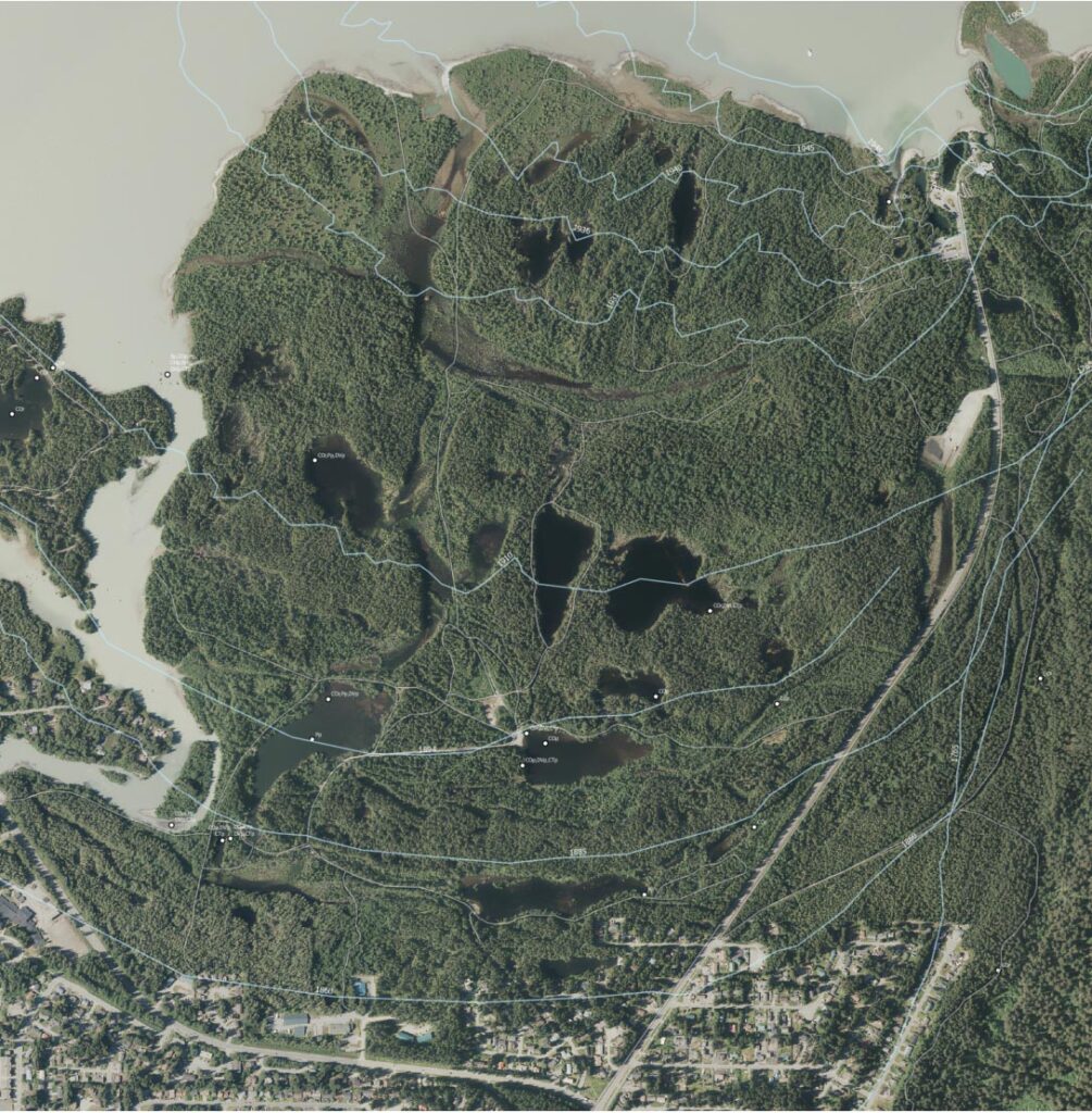
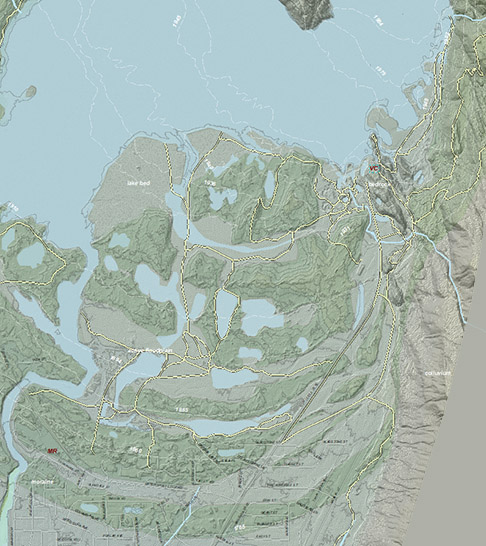
High-resolution GeoPDF pair for field navigation in upper Áak’w Táak, inland from little lake (Mendenhall Valley). Includes on-foot destinations from Mendenhall River Elementary (MR) and the Glacier Visitor Center (VC), In apps such as Avenza, on your phone or tablet, you can see your GPS/cell-triangulation position on this image, and lay a track.
First choice below is a 2013 LiDAR-derived bare-earth hillshade with modeled streams and 10-foot contours. Other layers, exported from ArcMap, are named roads, hiking trails, and surficial geology units. Dashed white lines show dated glacier terminus positions
The second choice is a 2023 orthophoto with overlain dated ice-lines, trails, and fish points from AWC (anadromous waters catalog) . More information on geoPDFs and use of Avenza is at Media types>Maps&geoPDFs., and at Tools>Field navigation.
Download hillshade geoPDF here (4MB)![]()
Download 2023 aerial geoPDF here (7MB)![]()