
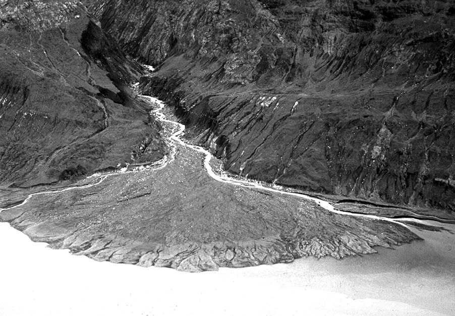
Staney Creek
Stream work documentation on Tàan, sea lion (Prince of Wales Island) The Nature Conservancy, US Forest Service, and dozens of…
2020 | Richard Carstensen | 19 minute slideshowDiscoverySoutheast.org

These illustrations were created for different projects. Upper one was part of a middleschool geology curriculum. Lower one was commissioned by Alaska Dept of Fish & Game for a publication on salmon. I’d been working on Jordan Creek [no Lingít name?], behind Sítʼ Eetí Shaanáx (Glacier Valley Elementary), and was thinking about that dynamic-&-youthful system when laying out the alternating pools and riffles so important to spawning and rearing habitat. Only later did I notice how the snakey meanders in the 2 block diagrams mirrored each other.
I was wrong. For example, I could find nothing on why exceptionally large trees cluster where streams approach the heads of lakes. Maybe it’s because so little undeveloped alluvial surface remains throughout the world. I guess it’s up to us Southeast Alaskans!
Top: As a geologist sees alluvial landforms. Below: As a naturalist sees them.
Stream work documentation on Tàan, sea lion (Prince of Wales Island) The Nature Conservancy, US Forest Service, and dozens of…
2020 | Richard Carstensen | 19 minute slideshow
Going back clearwater (Montana Creek) In late May, 2019, Discovery naturalist Steve Merli and I explored the middle reaches of…
2019 | Richard Carstensen | 5-minute slideshow
In 2013 I participated in a 3 day teacher’s conference called STREAM: a Pedagogy of Place. During this “place-based” conference…
2013 | Richard Carstensen | 7 pages
This document assembles aerial imagery and other GIS-based maps of Montana Creek for use by teachers in class and field.…
2013 | Richard Carstensen | 22 pages
Four-fold brochure created for the CBJ Natural History Project describes 11 interpretive stations along the lower Montana Creek Trail. On…
2013 | Richard Carstensen | 2 pages
Documenting change through repeat photography in Southeast Alaska Carefully framed retakes of historical photographs documenting vegetation and landform change in…
2005: 2nd ed, 2013 | Richard Carstensen, Kathy Hocker | 39 pages
Northern challenges As you might expect, our highest-scoring Landmark Tree stands are on the central and southern Tongass. But we’ve…

How bedrock foundations, glaciers, rivers and sea shape the land How bedrock influences the shape of mountains and coastal landforms.…
2013 | Cathy Connor|Richard Carstensen | 28 pages
Our laminated 4-fold guide to Streamwalking is the guide you’ll want in your pocket when you’re sleuthing the borders of…
2003 | Kathy Hocker & Richard Carstensen | 4-fold laminate
Connections between the living and non-living world Feature article on response of flora and fauna to geologic landforms and bedrock…
Spring 2011 | Richard Carstensen | 12 pages