Going back clearwater (Montana Creek)
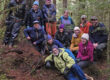
In late May, 2019, Discovery naturalist Steve Merli and I explored the middle reaches of Kax̱dig̱oowu Héen, going back clearwater, sometimes called Montana Creek (though nobody knows why). We were scouting for a teachers’ seminar focusing on the watershed. We began at the confluence with the complex and highly active floodplain of McGinnis Creek, and finished at old Montana Bill’s place, where Kax̱dig̱oowu Héen crosses under Back Loop Road.
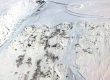
This 5-minute slideshow is sprinkled with aerial video and LiDAR-based hillshade views that have vastly enhanced our understanding of the rich, Kax̱dig̱oowu Héen. For a longer program on the watershed, see the talk I gave with John Hudson this past winter.
Landforms class revisit, 2022:
In September, 2022 I again visited Kax̱dig̱oowu Héen’s ‘fossil bluffs’ with Cathy Connor and the landforms class. Immediately across ‘dipper bridge’ from road’s end parking, there’s a good view of the 75-foot-high bluff where RD Miller’s map shows a foraminiferan collection site. Carl Blanchard’s ~39K pre-Wisconsin sample-site is a bend or two upstream, ~600 yards NNW. Since my journal from the May, 2019 scouting walk with Merli never made it into any shared documents, I’ll include a sidebar on that in the course scoping/journaling manual.