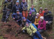
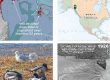
This document assembles aerial imagery and other GIS-based maps of Montana Creek for use by teachers in class and field. It was originally assembled for use during the STREAM: Pedagogy of Place conference in 2013. Download Here (6MB): ![]()
2013 | Richard Carstensen | 22 pages