Excerpt from a 2007 Fireside talk
From 2004 through 2005, then-Discovery naturalist Kathy Hocker and I conducted the Repeat Photography Project, using historical images to document, analyze and understand change. JuneauNature has a lot of material from those adventures, including a 40-page summary report, and separate documents featuring our ground-based and our aerial retakes.
But our most comprehensive retrospective on the methods and findings of Discovery’s Repeat Photography program was the fireside talk we gave in winter 2007. We tag-teamed this review in 2 forms. First, the live version at Glacier Visitor Center, and secondly as a powerpoint with attached audio. I’ve long wanted to convert that presentation to a form more compatible with archiving and streaming.
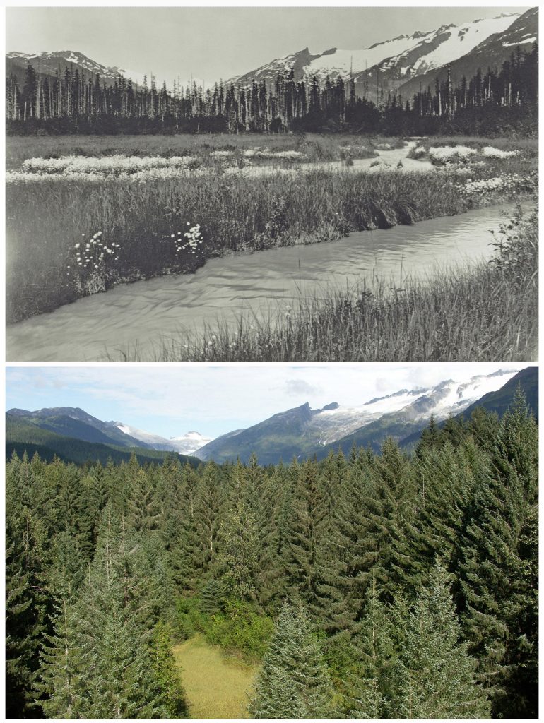
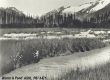
Above: Winter & Pond, circa 1910: Below: same scene from treetop, Hocker &Carstensen, 2005
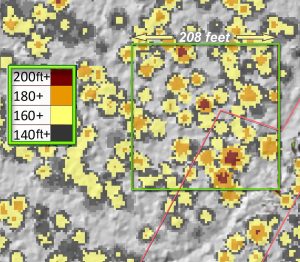
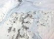
Canopy height model for a potential landmark trees acre 250 yards upvalley from Glacier Highway. It could score higher than any acre we measured in pre-LiDAR days, before heights were measurable on computer.
For now, moving into winter 2026-27, I’m especially interested in the valleys of Asx̱’ée—L’ux̱ (Eagle & Herbert Rivers). A lot is going on out there, and those valleys may need our help. My mentor Donald Lawrence, who introduced me to Repeat Photography and the study of post-glacial succession in the 1980s, asked me just before he died to look out especially for the Herbert, which he considered the best remaining natural laboratory in the world for that research—better even than Glacier Bay in some ways, such as ease of access. Don had watched his study plots in Áak’w Táak, inland from little lake (Mendenhall Valley) disappear under expanding suburbs, and knew this could happen also OTR (out-the-road)
In this photo pair between Asx̱’ée and L’ux̱, succession has been additionally complicated by glacial rebound. Those cottonsedge meadows in the 1910 black&white were colonizing flats that had been tidal less than a century earlier. And a century later they supported spruces so tall we couldn’t see the glacier. Fortunately some were open-grown, with big, trustworthy branches extending all the way to ground. No drones in 2007, so up we went.
Another technology we couldn’t have foreseen in 2007 is LiDAR. On terrain models we now see landforms in exquisite detail that were ‘invisible,’ even in the field, in 2007. Surficial geology is essential to understanding postglacial succession, where substrate can be more important than even surface age to habitat structure. And in the LiDAR point cloud, we can color-code tree heights .
Comparing LiDAR from 2013 with 2023 in this raised river terrace between the rivers is really exciting. No spruces in 2013, no spruces on that surface were taller than 180 feet—orange on the model above. By 2023, several had poked into the 200-ft+ class, brick red on the model above. I’m getting a little pokier in the devils club than back in the Landmarking days, so, like Don as he reached that stage, I’m looking around for future repeat photographers and big-tree admirers. If you’d like to help me find and document this forest, let me know. All you need to help are curiosity and leather gloves.