Subshed boundaries on the central CBJ
Better basin boundaries
During the Juneau wetland surveys in 2014, the Bosworth Botanical team (Koren Bosworth, Catherine Pohl, Andrew Allison and I) used an assessment protocol designed by Paul Adamus that relied heavily on watershed conformation. How big, for example, is the “contributing area” for a convex bench bog, on a gently sloping knee-shaped buttress extending out from the valley wall? Miniscule, actually, compared to rich beaver fens downvalley from vast concavities reaching all the way to alpine highlands.
Prior to 2014, the only GIS polygon files depicting topographic basins were Hydrologic Unit Codes (HUC) by US Geological Survey, and Value Comparison Units (VCU) by the US Forest Service. Neither displayed true hydrologic watersheds, and both were far too coarse for our needs. So, as the summer proceeded, I began to draw my own.

Cover of our 4-page description of the process for finer, LiDAR-based delineation of ‘true’ watersheds in Áak’w & T’aakú Aaní.
I could do this at unprecedented resolution, thanks to a digital elevation model (DEM) commissioned for our project by CBJ’s Community Development Department. Whenever we needed to map the exact divide through a subtle landscape of peatland and scrub woodland, I could turn on the finest DEM-predicted tributaries, and look for where those branching ‘fingertips’ almost touched each other. For additional help on the gentlest terrain, I usually zoomed in and turned on 1- or 2-foot contours, likewise derived from that elevation model. We decided to call these new polygons “subsheds,” because they were sub-units of the much larger HUCs and VCUs.
By summer’s end I had a hand-traced shapefile covering all of the roaded CBJ. Ultimately, more proficient GIS users will automate these delineations, ‘predicting’ basin polygons in the same way as we generate the streams model. But for the CBJ, so far, basin-modeling is limited by the scope of the LiDAR survey. Generally, it extends only 500 to 1,000 feet up the hillsides (This also poses limitations in modeling of streams).
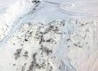
For now, I’ve resolved that problem by switching to 5-meter-pixel IfSAR at the upslope end of CBJ LiDAR coverage. This allowed me to trace larger basins extending back into the icefield with reasonable accuracy.
This 4-page PDF explains our process and criteria for delineation and naming of subsheds in the CBJ.
Download here (3MB): ![]()
The interactive map below, created in ArcGIS Online delineates watershed units for the Juneau. A contour hillshade map is the default, but by clicking the 4-square basemap symbol, you can choose imagery or other options. Clicking within any of the subshed units launches a popup with more information. Box in upper right allows search for any feature on the base map. Try entering your street address, or a natural feature such as a stream or mountain.