1950s-60s hi-res aerial photos taken before logging
While working at Staney Creek for the Nature Conservancy in 2018, I received from Jacob Hofman a huge collection of early USFS and pulp mill-sponsored aerial photography. He had scanned the 9×9-inch prints while working at KRD (Ketchikan Ranger District; Jacob is now Alaska Region Cartographer based in Juneau). The majority were taken in years just before industrial scale logging removed our most majestic old-growth forest from Tàan (Prince of Wales) and neighboring timberlands.
In this document I’ve assembled stereopairs from overlapping photos. The ability to scrutinize pre-logging forest structure or stream context from much lower elevation than prior 1948 or 1929 missions is valuable to any aficionado of Lingít Aaní. But it’s especially useful for workers such as the SAWC network (SE AK Watershed Coalition). trying to repair the damage of roading and clearcutting that swept our southern archipelago almost before these prints were dry. Stereopairs are necessarily high-resolution and I haven’t been able to load this 75-megabyte to JuneauNature. But John Hudson came to the rescue, loading it to SAWC’s extensive online archives.
Another reason for delay between first draft in 2019 and this posting in 2026 has been my lack of personal familiarity with many of these 3D scenes. I’ve been hoping others with more boots-on-ground would send me better captions . . . or hey, maybe current on-the-ground or drone imagery. If you have such experience or resources, I’m all ears, and would love to re-issue Stereoghosts-V2. And what important areas are missing from the collection?
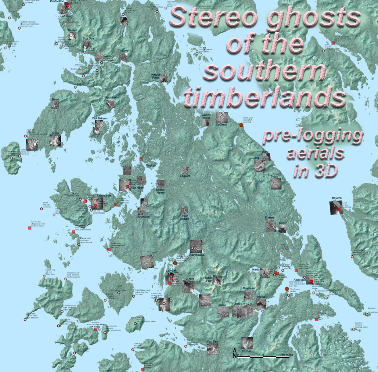
Locations for stereopairs of selected streams, karstland, communities, & iconic landscapes