Where we play (Rec), where we live (Homes), and what feeds us (Flats)
For a joint Sealaska Heritage-DiscoverySoutheast walking tour of The Valley on 20260804, I’m posting a draft watershed-scale map that helps us think about what’s top-of-mind for everyone right now; the 4th-annual GLOF, or glacial lake outburst flood. Since the first destructive one in August, 2023, they’ve all basically happened THIS WEEK. QR codes on left margin direct you to related resources on JuneauNature.
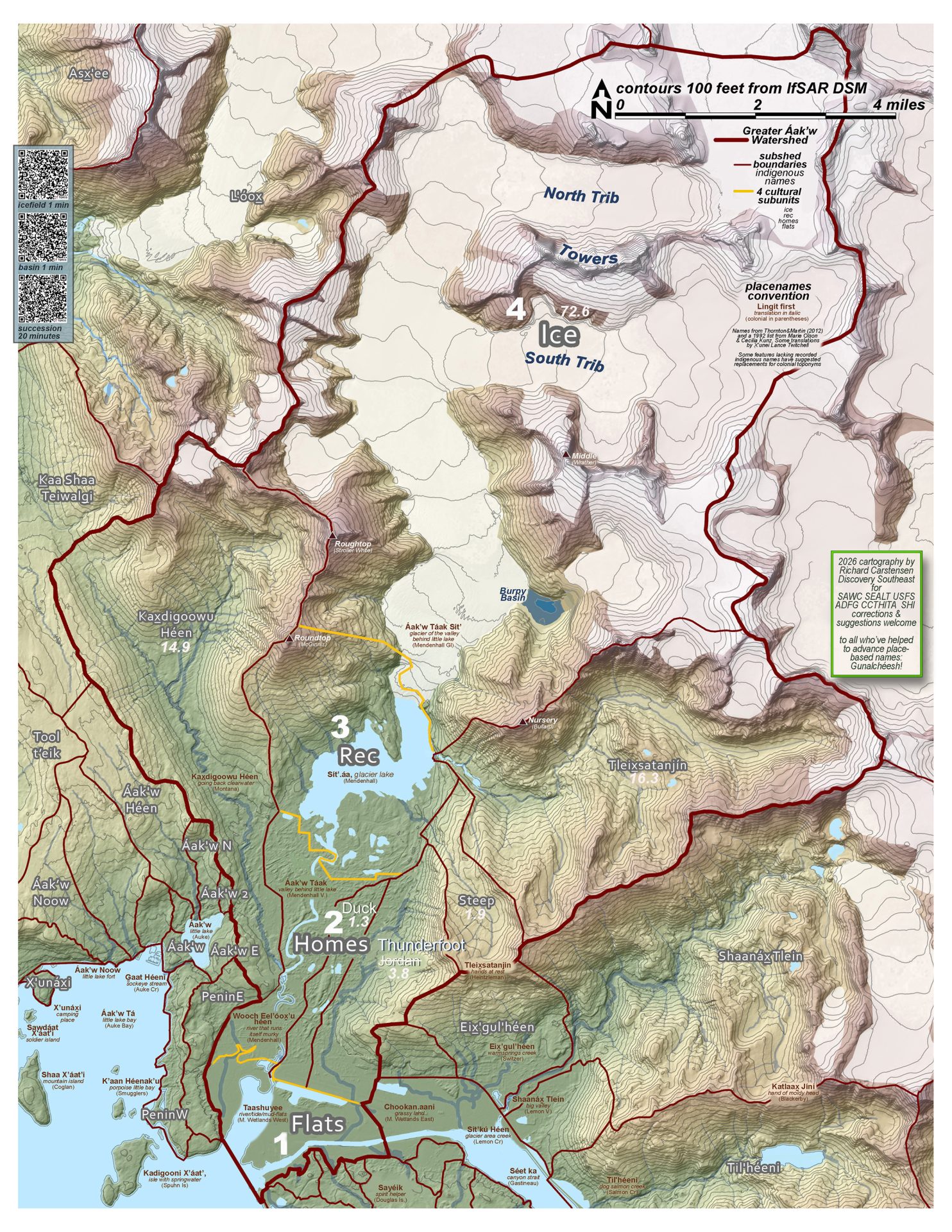
Especially tentative on this draft are place names. Discovery supports SHI in our community’s slow movement to move away from colonial or commemorative names honoring people. My sources for more place-based and indigenous names are listed in the key. HOWEVER, only a few of those names have been recorded, in a landscape where every prominent and even subtle feature once had a name and story. Where recorded names are lacking, I’ve proposed a few. For example, the most striking difference between Mounts McGinnis and Stroller is the former was glacially rounded, ~20K years ago, while the latter stood free, remaining jagged. So, how bout Roundtop and Roughtop?
Let me know what you think. Names are (or should be) constantly evolving, to reflect our deepening relationship to the country. Gunalchéesh! to Sealaska Heritage, for the opportunity to participate in this great convergence on northern Lingít Aaní!