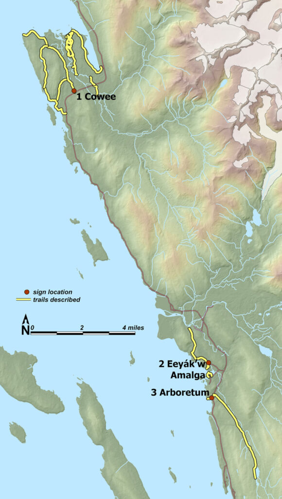
‘Out-the-road’ trail signs (red dots) and described networks.
Directory to 10 sign stations on favorite borough trails
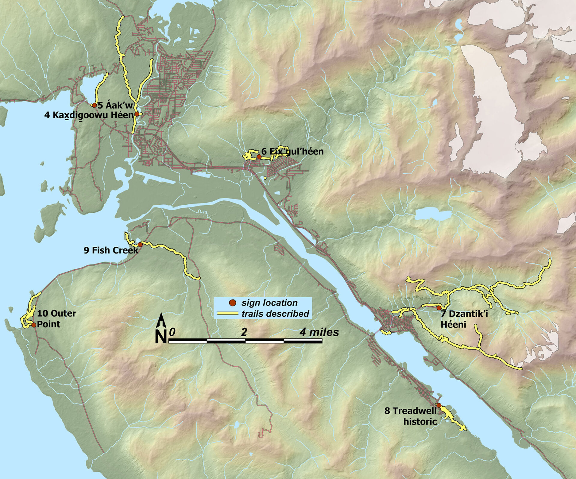
From 2007 to 2010, on contract with CBJ Parks and Recreation, I designed 3-panel trailhead signs, for 10 watersheds selected by then-P&R director Mark Matsil. Of those 10 trail systems, 7 are on the mainland and 3 on Sayéik (Douglas Is). Red dots are sign locations and yellow lines are trails described. I love to see folks taking cellphone pics of the signs, but always tell them it’s unnecessary; high-res digital versions of maps & text are downloadable here has pdfs:
In addition to pdfs for the sign contents, interpretive brochures are available. They can be printed double-sided on legal-sized paper as 4-folds, or, more simply, loaded to your phone for use on the trail. (2025: Someday I hope to convert these to a more interactive and device-friendly format. But meanwhile you’ll have fun with all the ‘old-school’ illustrations and natural history info.)
Mainland watersheds, north to south:
● 1 Cowee Meadows, Ch’eet’ Taayí, murrelet fat (Cowee Cr.) signs pdf ● Cowee-brochure
● 2 Eeyák’w, small rapids (Amalga) signs pdf ● Amalga-brochure
● 3 Arboretum signs pdf ● Arboretum-brochure
● 4 Kaxdigoowu Héen, going back clear water (Montana Cr). signs pdf ● Kax̱-brochure
● 5 Áak’w, little lake (Auke Lake) signs pdf ● Áak’w-brochure
● 6 Eix’gul’héen, warm springs creek (Switzer Cr) signs pdf ● Eix̱-brochure
● 7 Dzantik’i Héeni, little flounder creek (Gold Cr) signs pdf ● Dzanti-brochure
Sayéik (Douglas Is) watersheds:
● 8 Anax Yaa Andagan Yé, where the sun’s rays hit first (Treadwell historic) signs pdf ● Treadwell-brochure
● 9 Fish Creek signs pdf ● Fish-brochure
● 10 Outer Point, Kaalahéenak’u, inside a person’s mouth (Peterson Cr): signs pdf ● Outer-brochure
Trail signs on mainland continue, numbered NW to SE, then cross to the island side.