History from the air
Georeferencing old and recent vertical air photos in ArcMap makes it easy to export exactly scaled-&-aligned images, displayed on successive pages of a pdf for easy point-to-point comparison. This set of 9 begins in with LiDAR ‘bare-earth, then runs from 1910 through 2013. PS 2025: Floyd Dryden school is temporarily (?) closed. But I still like the framing of this map series, centered halfway between the 2 schools and showing all of the giant fan we logged in the mid 1940s. If, in using this series for your classes, you come up with a script or annotations to bump my placeholder xxxxx-s, Please send them along.

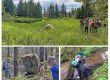
Cover of pageflippers for Sít’ Eetí Shaanáx-Glacier Valley Elementary
.