Terminal moraine at Glacier Bay
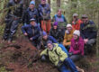
In July, 2024, Koren Bosworth brought 4 of us to her home on the outwash plain of Sít’ Eeti G̱eeyí, bay in place of the glacier (GB 3rdname). The Park Service had asked us to delineate wetlands, search for rare or non-native plants, and identify interpretive opportunities on a proposed loop trail. We mapped and botanized, and stewed inside heavy raingear. The sun came out just as we broke out of the forest on our last field day 🙂
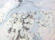
Next summer a host of volunteers are planning the 5th Glacier Bay Science Symposium, a memorial to our friend and mentor Greg Streveler who died just days after our visit. The Notch, named for pioneering ecologist and park advocate William Cooper (but best decolonized in my opinion), is shaping up to be a logo of sorts for that event. From the ground it’s hard to photograph this feature, however significant. And you can’t fly a drone in the park. So for aerial perspective, here’s a completely legal oblique orbit, starting out in the LiDAR pointcloud to visualize forest structure. Then, halfway through, we strip away the trees for a look at glacial landforms on bare earth (LiDAR’s digital terrain model).
Here’s just the flora and habitat descriptions, mostly by Koren, from our 93 page report to NPS. Download 10MB pdf here ![]()
Happy to share the full report; it’s just a little large for download from JuneauNature. For me as cartographer, it was a delight to work with the bare-earth and pointcloud, higher resolution than other canopy models I’ve seen so far. What a wonderful insight into the structure of forests coming in after glaciation, then hammered by beetles in the 1980s.
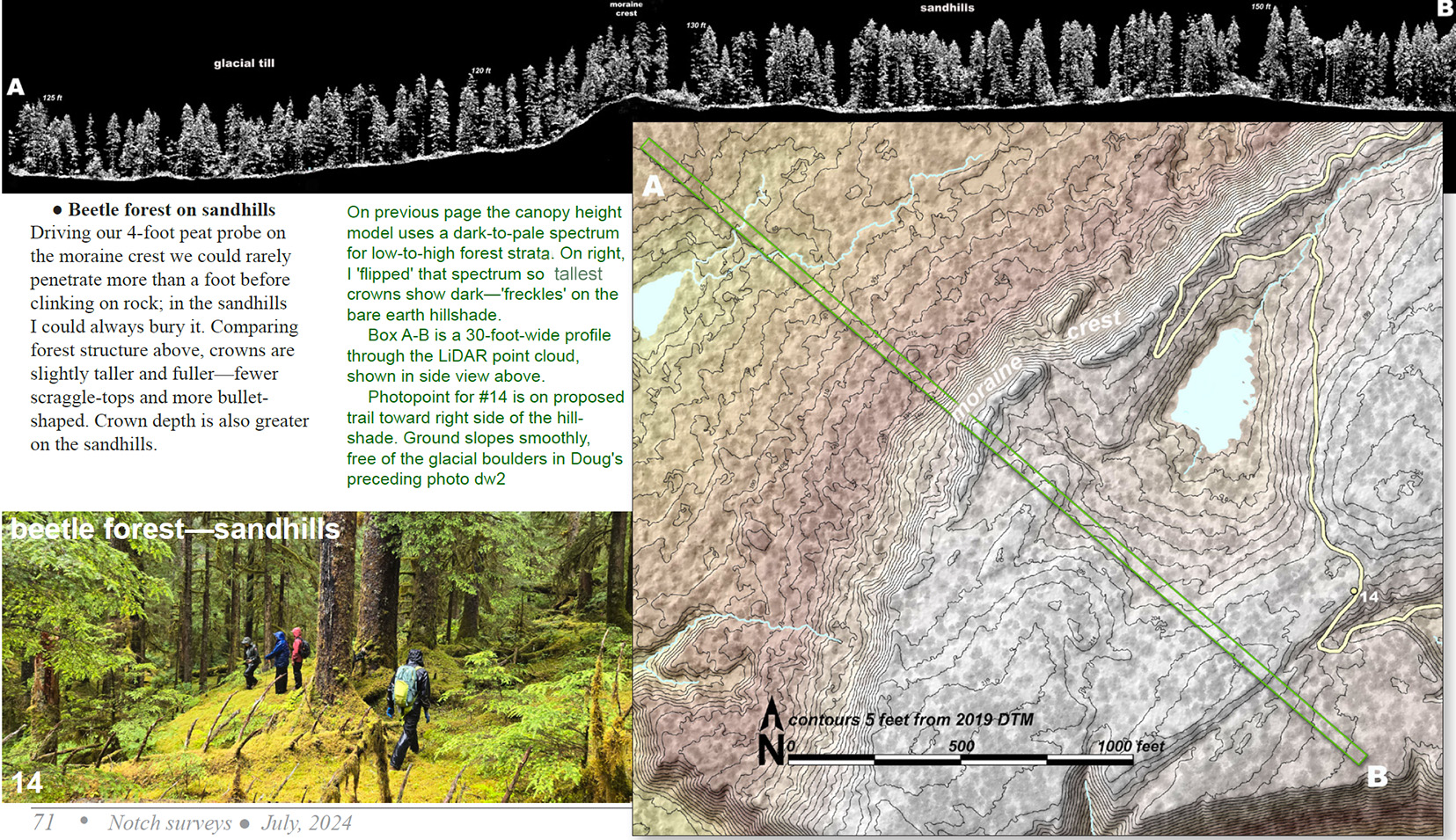
Sample page from our report to the Park Service