Drone tour in spring, 2017
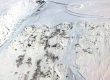
I’m only just putting up this slideshow for the vast glacial foreland stretching southeastward from Visitor Center to Backloop Bridge. It also spans the area mapped between 1931 and 1958 by Charles Forward on contract with the Forest Service. He showed not only exact positions of the retreating icefront, but also the ephemeral ponds and shifting outwash channels. My drone video compliments Forward’s maps with current views from raven’s elevation. Well, maybe not exactly current 🙂 It did for some reason take me 9 years to post to JuneauNature!