Rock-type units from USGS
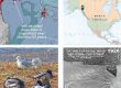
Here’s a geology map for field navigation in more accessible portions of the Greater Chilkat Watershed—US side only. This geopdf is an interim product, to be updated as we ground-truth it.

Bedrock geology, from US Geological Survey that I merged and ‘stratified.’ ‘Rock family’ colors in key, right, group units into coarse, ecologically relevant categories comprehensible to layfolk. Loaded to your phone or tablet and displayed in Avenza (instructions here), you can display your position and track, and attach your photos, exporting a Google Earth kmz to display your photopoints.
Download geopdf_chilkatgeo.pdf here 22 MB: ![]()
My draft chapter in the GCW Atlas gives background on rock types, faults, geologic terranes, etc. My adaptation for geopdf preserves the code abbreviations shown here, adding brief list of the unit’s dominant rocks, and a field for time-period: capital letters in these codes.
My surficial geology layer for GCW is ‘extended’ northwestward from the beautiful work of RD Miller in Áak’w and T’aakú Aaní. It uses colorcodes from his unit-types, and is currently pretty coarse. Definitely a work in progress, that could benefit from a lot of ground-truthing by residents!
Download bedrock, surficial and glacier chapters here (low-res version) 3MB: ![]()