Natural and cultural history of Amalga meadows and Tool T’eik (Peterson Creek)
In 2007, moving into a 4-year interpretive signage project for 10 CBJ watersheds, I set up ‘scoping’ documents, receptacles for pretty much everything I could find on the geology, biology and human history of those areas. As years passed, these documents took on a standardized format. Part 1, Scoping, is a traditional bedrock-to-bugs summary, from multiple sources. Part 2 Journals, contains detailed notes, maps and photos from each site visit deemed worthy of inclusion. These are followed by Appendices.
In the case of Amalga-Peterson/Eeyák’w, it’s taken me, lessee, 2025-2007 =18 years to get this one organized for uploading to JuneauNature. Sorry 🙂
At 117 pages, a full-res pdf would be too large for archiving. I’ve compressed this to a manageable 15mb. Some of the tiniest labels on maps might be soft, but it’s impressive what acrobat can do these days.

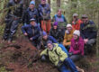
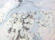
Sample pages from the scoping and journals document