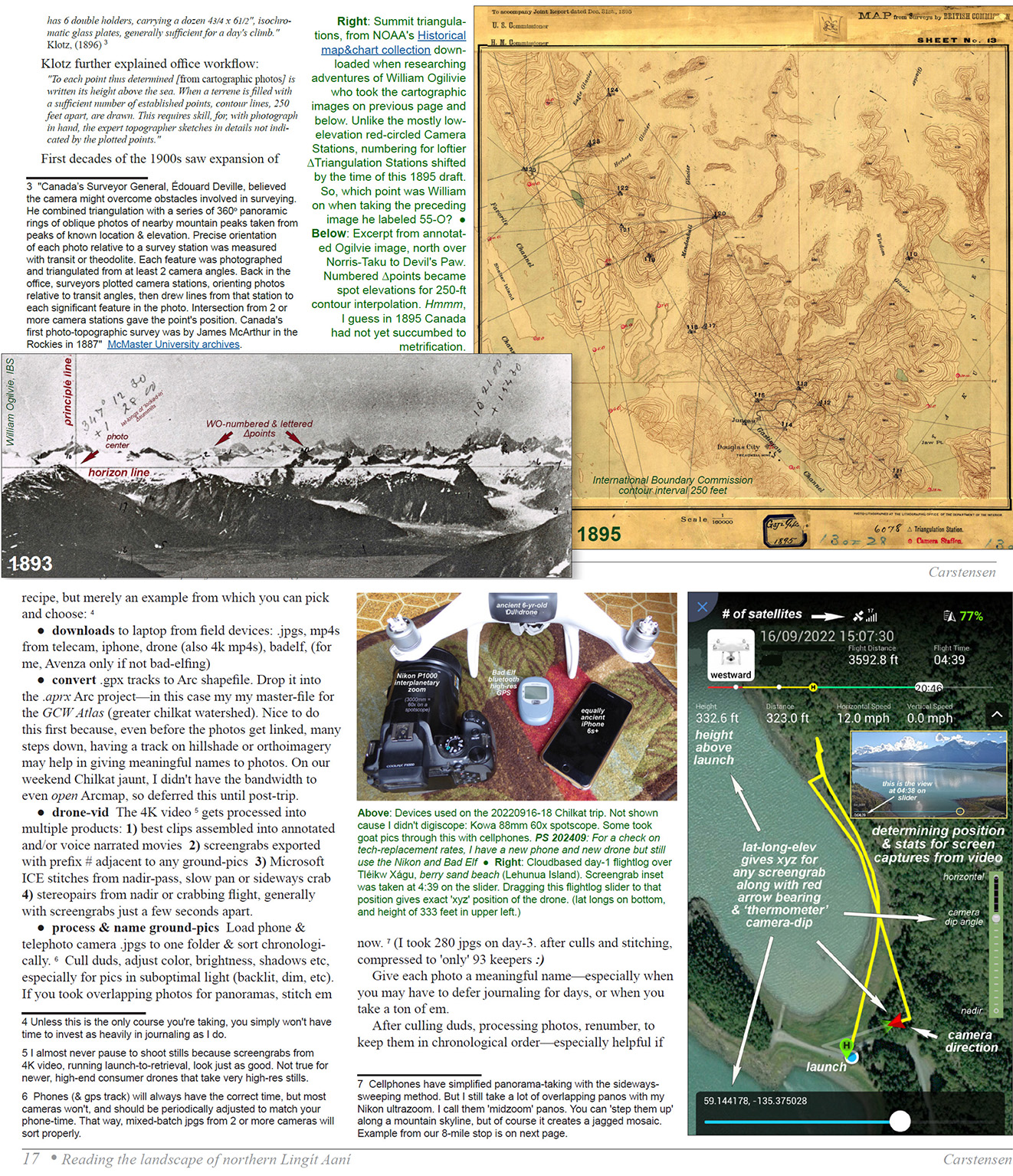
From theodolite to LiDAR
Teaching geol-393—Reading the landscape of northern Lingít Aaní—with my friend Cathy Connor in fall 2022, I wanted our students—earth-sci majors and fellow&sister greyhairs—to appreciate the evolution of mapping technology, across the two and a quarter centuries since first contact. I had many questions about a pair of ship commanders, Vancouver & Meade, nearly a century apart but scarcely different in terms of carto-sophistication. And then suddenly, driven largely by US-Canadian competition over borderlines, an explosion of aggressive mountaintop triangulations by rugged bushwackers like Ogilivie.
These introductory pages from our course manual cover not only cartography but journaling, and some tips for documenting outdoor adventures. For serious naturalists they kinda go together. Download 6MB pdf here ![]()
Sample pages 8 and 16 from our course manual for Reading the Landscape.