The Wayback app
JuneauNature relies heavily on historical series from precisely registered aerial photographs, presented either in slideshows, with long dissolve between successive images, or in pdfs on successive pages, for toggling through the decades, comparing specific points-of-interest. A great new resource for recent orthophotography is ESRI’s Wayback, This is a standalone application that doesn’t require the user to have ArcMap software. From their homepage, simply click View application in the upper right. That’ll take you to a window like this, that opens in desert California. From there, scroll north to your rainforest destination.
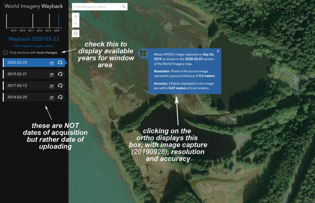
ESRI’s Wayback App displaying ArcGIS Online’s current imagery for Fish Creek delta. It was shot September 26th, 2019 and loaded March 23rd, 2020. Three prior image years can be displayed by clicking your way down the table-of-contents on the left.
Like Google Earth’s “historical imagery” slider, Wayback will only take you back through 15 or 20 years of recent orthoimagery. For a deeper look back in time, I rely on the Navy archives from 1948 and 1929 missions. These have not been georeferenced, so each image must be individually loaded to ArcMap, scaled, rotated, rubber-sheeted and “pinned,” before it can be used in a historical series.